General Karte vom Europaischen Russland (1844) C.F. Weiland
This map contains pre-1843 boundaries. Kovno gubernia was administered by early 1843 but does not appear here where the original boundary of Vilna guberniia is pictured. Thus the date of the map is slightly confusing if one is looking for the Kovno province.
Courtesy of the University of Chicago.
Full Image: General Karte vom Europaischen Russland
South-West Russia (1912) Keith Johnston
A variety of political boundaries from different centuries are pictured. In bold red is the boundary of the former Polish-Lithuanian Commonwealth before it's partition in 1772; the Congress Kingdom of Poland, established 1815 is bounded in green. Gubernia divisions are included and dates of significant battles are located by a symbol of crossed swords.
The growth of Russian railways can be followed in these maps. Of the four versions, the 1879 and 1893 have the most extensive and well marked rail routes.
- Full file view: 1861
- Zoom viewer: http://www.davidrumsey.com/luna/servlet/detail/RUMSEY~8~1~21321~620021
- Full file view: 1879
- Zoom viewer: http://www.davidrumsey.com/luna/servlet/detail/RUMSEY~8~1~37173~1210150
- Full file view: 1893
- Zoom viewer: http://www.davidrumsey.com/luna/servlet/detail/RUMSEY~8~1~37973~1210986
- Full file view (1912) with thumbnail at right.
- Zoom viewer: http://www.davidrumsey.com/luna/servlet/detail/RUMSEY~8~1~37661~1210651
Courtesy of the David Rumsey Collection.

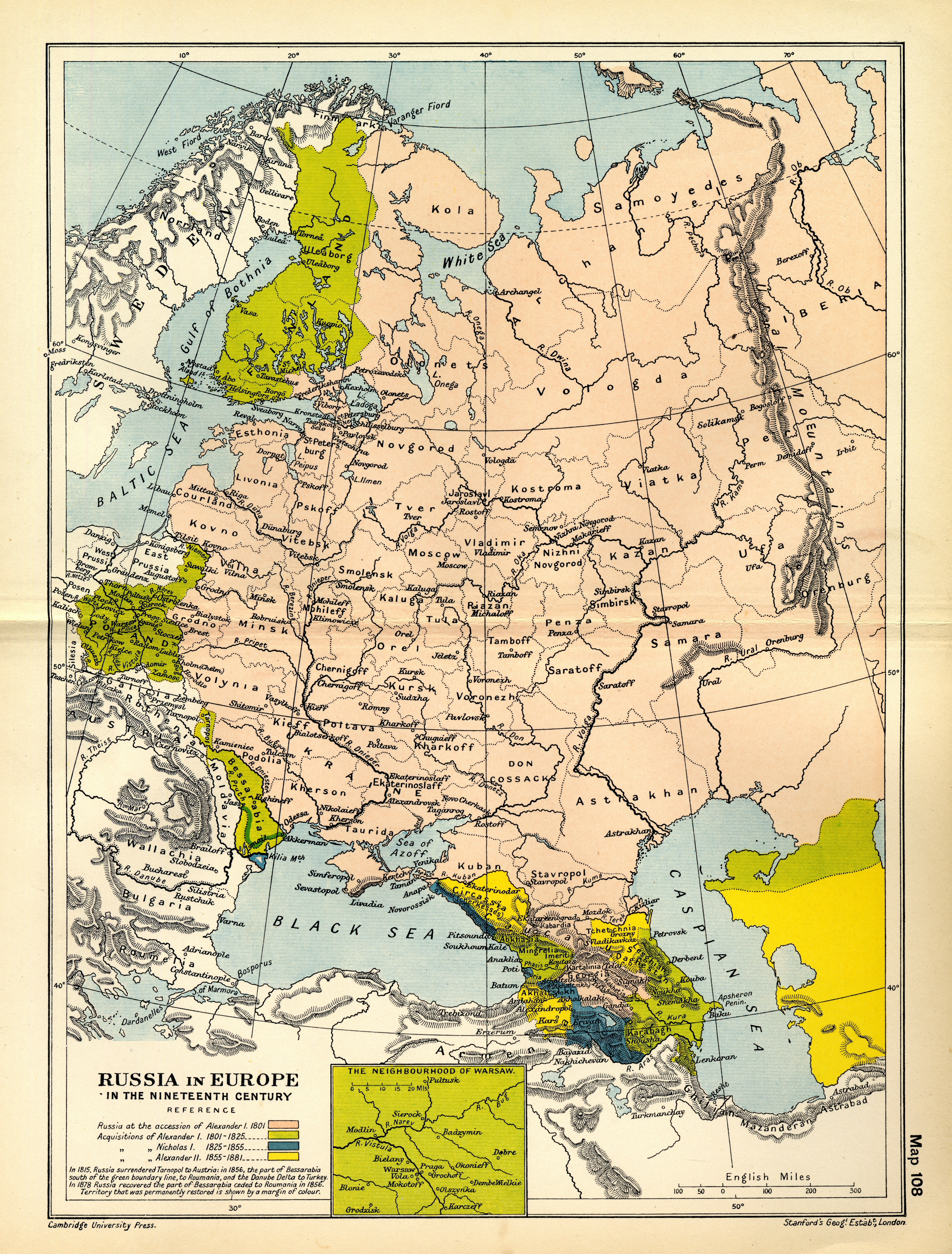
Russia in Europe in the Nineteenth Century (1912) Cambridge Atlas
Russia's 19th century territorial acquisitions are pictured here.
Europaisches Russland (1825) Stieler
Courtesy of the David Rumsey Collection
Full file view with thumbnail at right.
Zoom viewer: http://www.davidrumsey.com/luna/servlet/detail/RUMSEY~8~1~244274~5513715

Russia and Poland (1832) Arrowsmith
The outline of the former Polish-Lithuanian Commonwealth is added in red, except the former district of Warmia within East Prussia.
Courtesy of the David Rumsey Collection
Full file view with thumbnail at right.
Zoom viewer: http://www.davidrumsey.com/luna/servlet/detai/RUMSEY~8~1~33862~1170014:

Ost-Europa in 6 blattern (1875) Stieler
Courtesy of the David Rumsey Collection
Full file view with thumbnail at right.
Zoom viewer: http://www.davidrumsey.com/luna/servlet/detail/RUMSEY~8~1~2444~240020:

Carte-de-la-partie-europe'enne de l' Empire de Russie (1809) Depot Imperial de Cartes
Source: http://maps.bpl.org/id/14682
Full Image: Carte-de-la-partie-europe
The_Growth_of_Russia_in_Europe_1300-1796 (1923) Historical Atlas by William R. Shepherd
Source: http://www.lib.utexas.edu/maps/historical/history_shepherd_1923.html

Kriegsstrassen Karte eines Theiles von Russland (1837) F.T. Schubert
Courtesy of the David Rumsey Collection
Zoom viewer:
http://www.davidrumsey.com/luna/servlet/detail/RUMSEY~8~1~247635~5515666
Full Image: Kriegsstrassen Karte eines Theiles von Russland
