Atlas Containing Ten Maps of Poland 1837 J. Bansemer & P. Zaleski
From the: Atlas Containing Ten Maps of Poland Exibiting the Political Changes That Country Has Experienced
During the Last Sixty Years, From 1772 to the Present Time, by Jan Marcin Bansemer & Piotr Falkenhagen Zaleski, 1837.
Courtesy of Biblioteka Jagiellonska, Krakow.
|
Poland in 1772 with its Principal Geographical Divisions
|
_J.M.jpg) |
|
Poland in 1772 after the First Partition
|
_J.M.jpg) |
|
Poland in 1793 after the Second Partition
|
_J.M.jpg) |
|
Poland in 1795 after the third Partition
|
_J.M.jpg) |
|
Poland in 1807 after the Treaty of Tilset
|
_J.M.jpg) |
|
Poland in 1809 after the Treaty of Schonbrunn
|
_J.M.jpg) |
|
Poland in 1815 after the Congress of Vienna
|
_J.M.jpg) |
|
Poland in 1831 after the War of Independence
|
_J.M.jpg) |
|
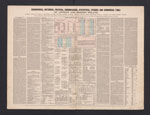
Geographical, Historical, Political, Chronological, Statistical, Literary and Commercial Table of Ancient and Modern Poland
|
 |
|
Poland and the Neighboring Countries according to the Religion of the Majority
|
_J.M.jpg) |
|
Poland and the Neighboring Countries according to the Language of the Inhabitants
|
_J.M.jpg) |
