Late 18th-Early 19th C. Topographic
Many of the maps in this tab originated shortly after the last Partition of Poland in 1795. We might think of them as "proto" topographic since the display of
relief is limited by use of shading and/or hachures. Later around the turn of the 19th century contour lines and spot heights (numerical elevations) largely
replaced hachures in issues like the Karte des westlichen Russlands and Karte des Deutschen Reiches. However, the increased accuracy and detail of
symbols in the series here make them essentially topographic. Symbols relating to Jewish life are scant in these images.
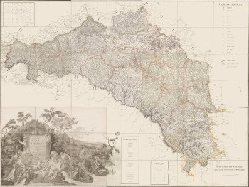
Regna Galiciae et Lodomeriae
J. Liesganig (1794)
Scale= 1:288,000
The skills of the cartographer and engraver are on display with the shading of hills
in perspective, revealing the topography.
From the National Library of Poland
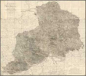
Carte von West Galizien
A.M. von Heldensfeld (1808)
Scale= 1:172,800
Courtesy of the David Rumsey Collection
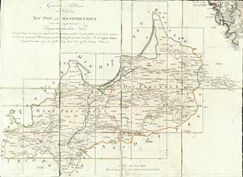
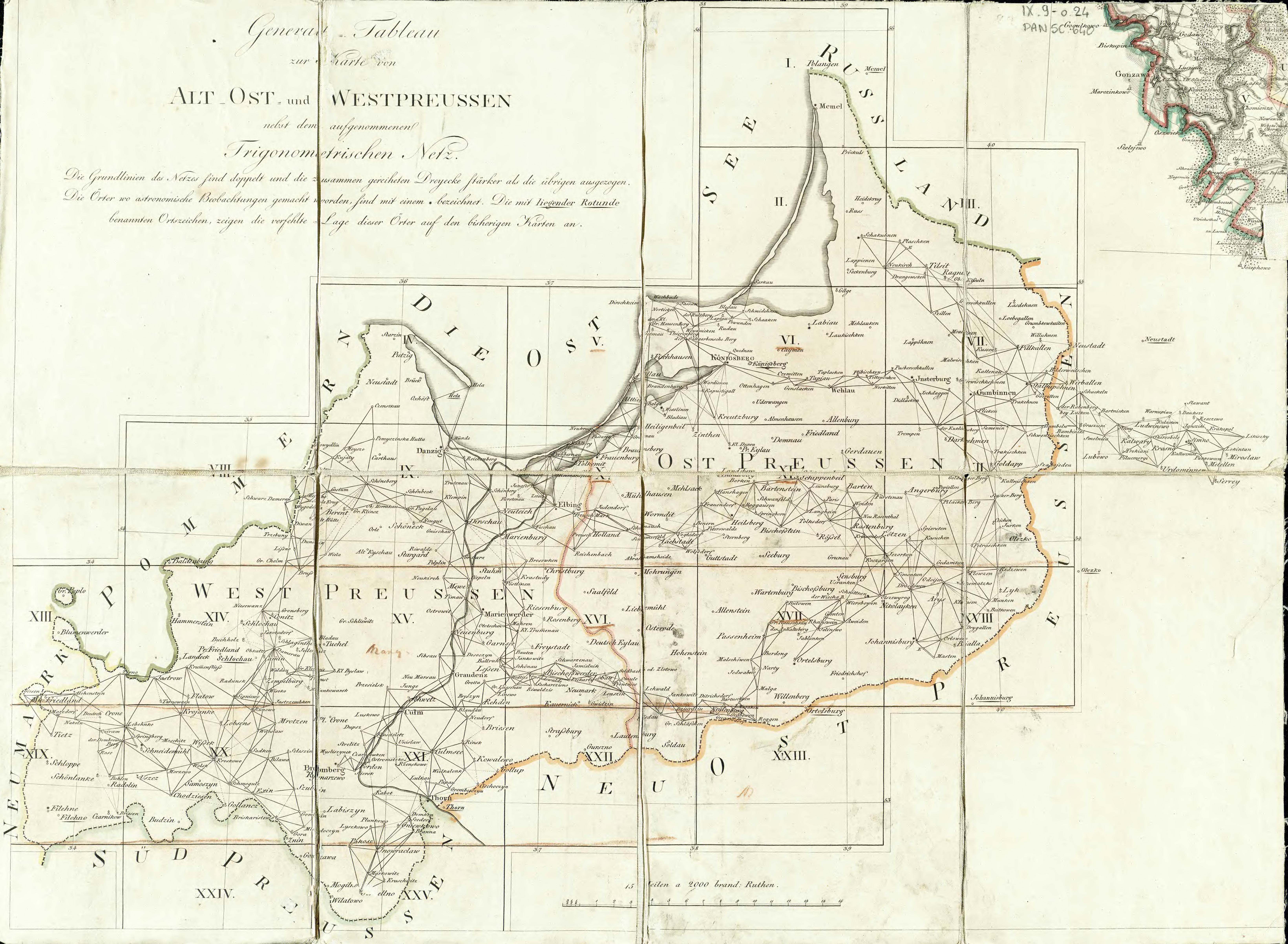
Karte von Ost Preussen nebst Preussisch Litthauen
und West Preussen nebst dem Netzdistrict
F.L. von Schroetter (1796-1802)
Scale= 1:150,000
A set of 25 maps completed between 1802 and 1812. Several types of terrain are
depicted and some topographic relief is shown by the use of hachures. A symbol
legend is found on sheet II-Schakuhnen. Sheet XXIII-Niedenburg contains an inset
of Konigsberg, the capital of East Prussia. Sheet VIII-Baldenburg contains an inset
of the city of Danzig.
Source: http://rcin.org.pl/dlibra/docmetadata?id=829
Here is a composite courtesy of the David Rumsey collection.
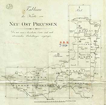
Neu Ost Preussen-Herztogthums Warschau
nebst dem Russischen District
D.F. Sotzman (1806-1808)
Scale= 1:150,000
Index image in section IV-Szczuczyn
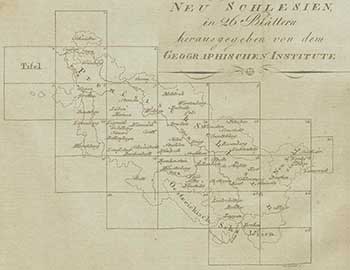
Topographisch-militairischer Atlas von Schlesien
Verlag des Geographischen Instituts Weimar (1809)
Scale= 1: 200,000
Title sheet contains a legend in German and French
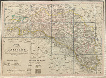
Uibersichts Karte von Galizien
Tranquillo Mollo (1820)
Scale = 1:145,000
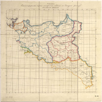
Семитопографическая Карта Иностраннымъ Владѣніямъ
по Западной Границѣ Россійской Имперіи
Semi-topographical map of Foreign Territories along the Western Borders of the
Russian Empire Karl Oppermann (1811-1820)
Scale=1:252,000
Title sheet at uppermost right of index contains a symbol legend, regional color key
and a list of Polish wojwodstwo and oblasti (provinces and regions or counties).
Sheets are variously joined.
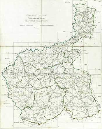
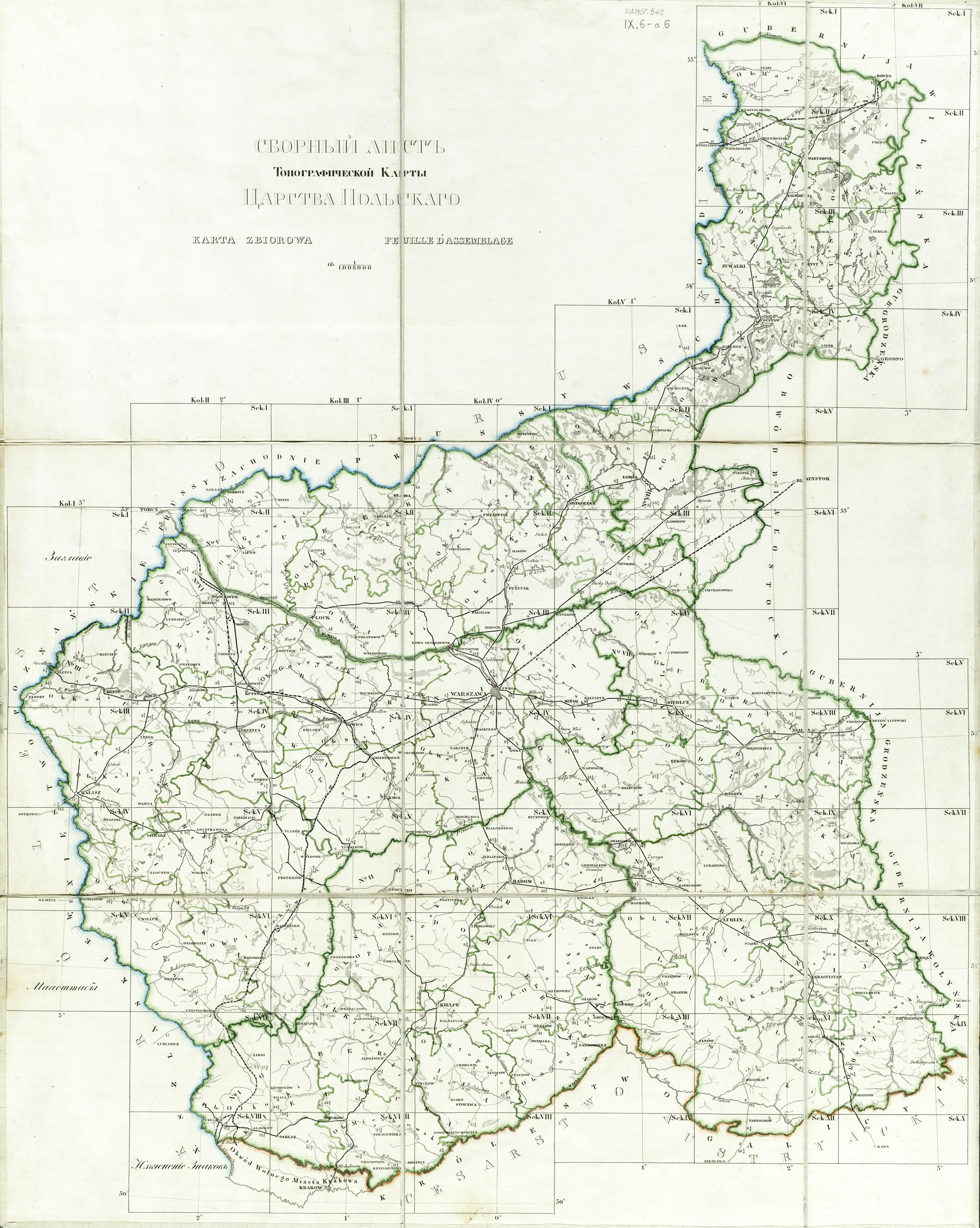
Topografičeskaâ karta Carstva Pol'skago
Topographic Maps of the Kingdom of Poland
Karol Richter (1839)
Scale= 1:126,000
Title sheet and index contain a few inscriptions in Cyrillic but maps are Romanized.
Section II-8 Slawkow contains a legend in Polish, Russian
and French.
