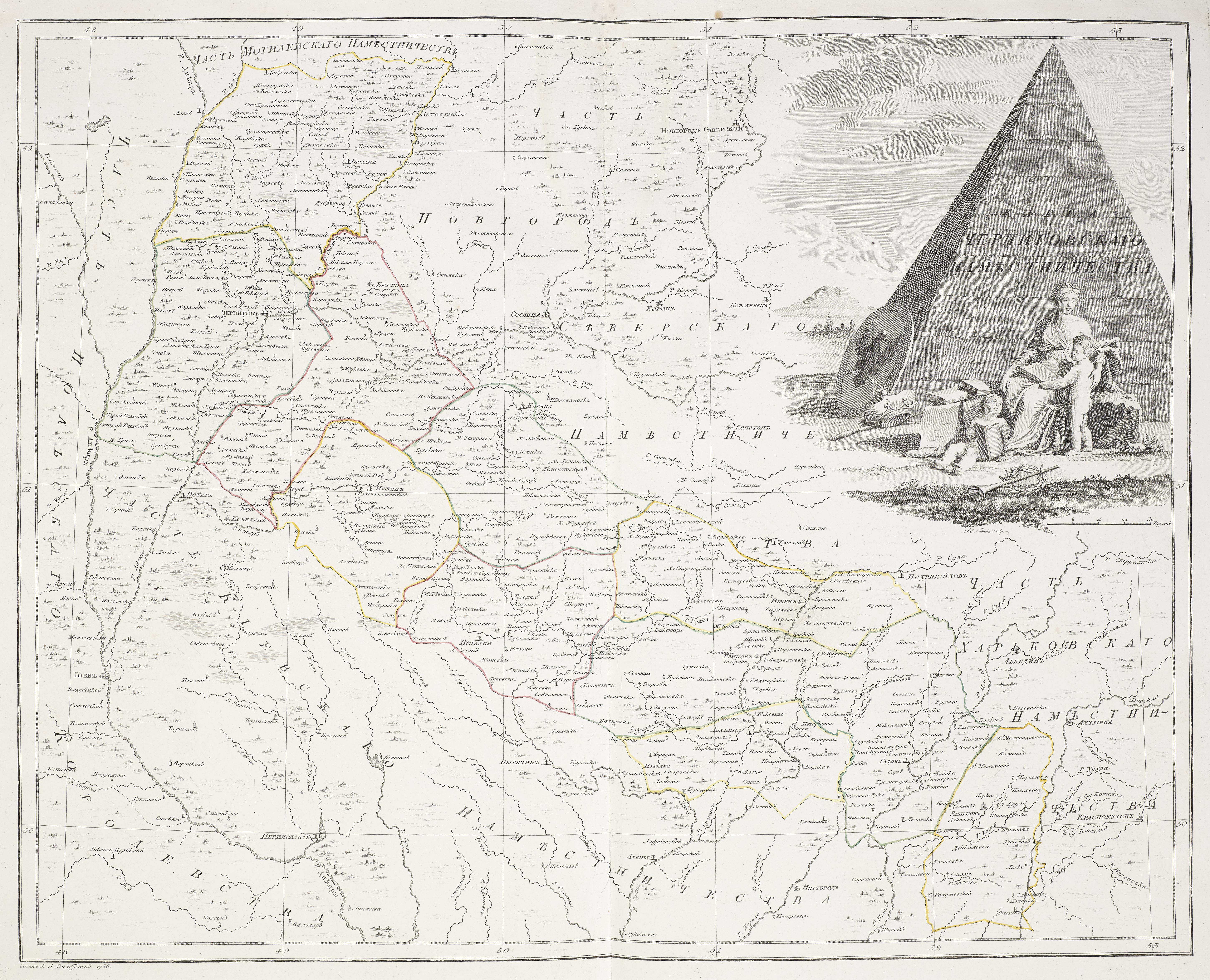
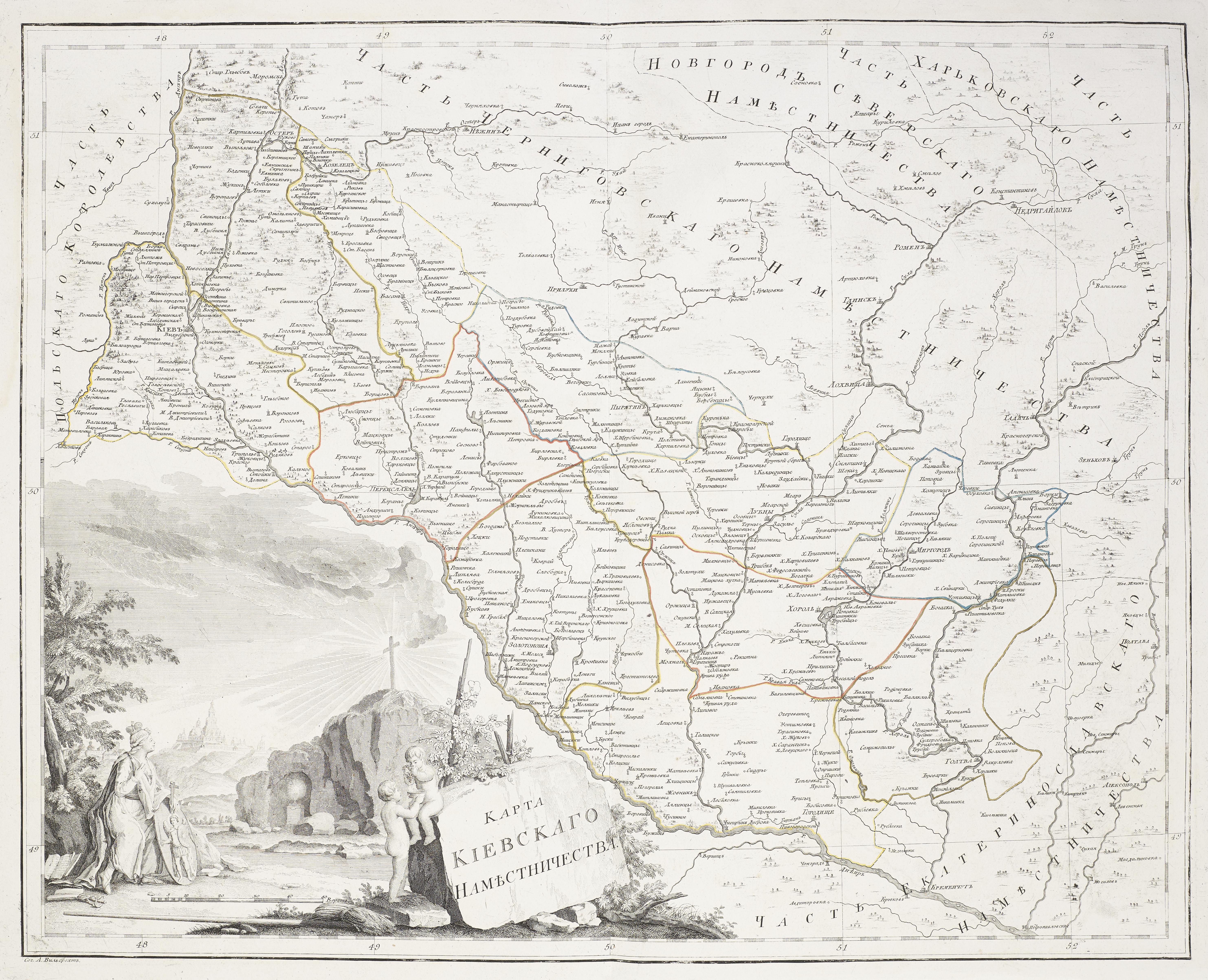
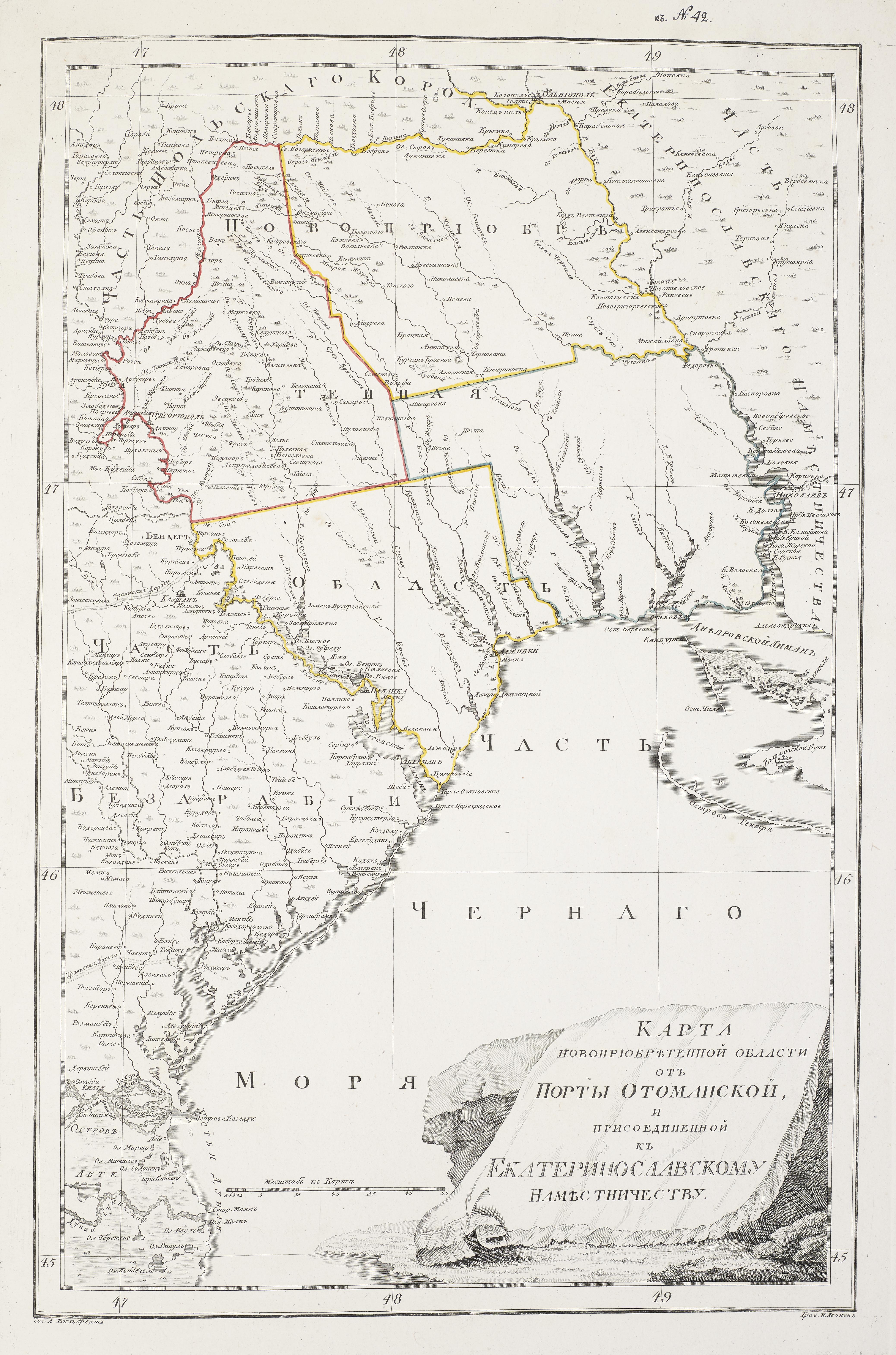
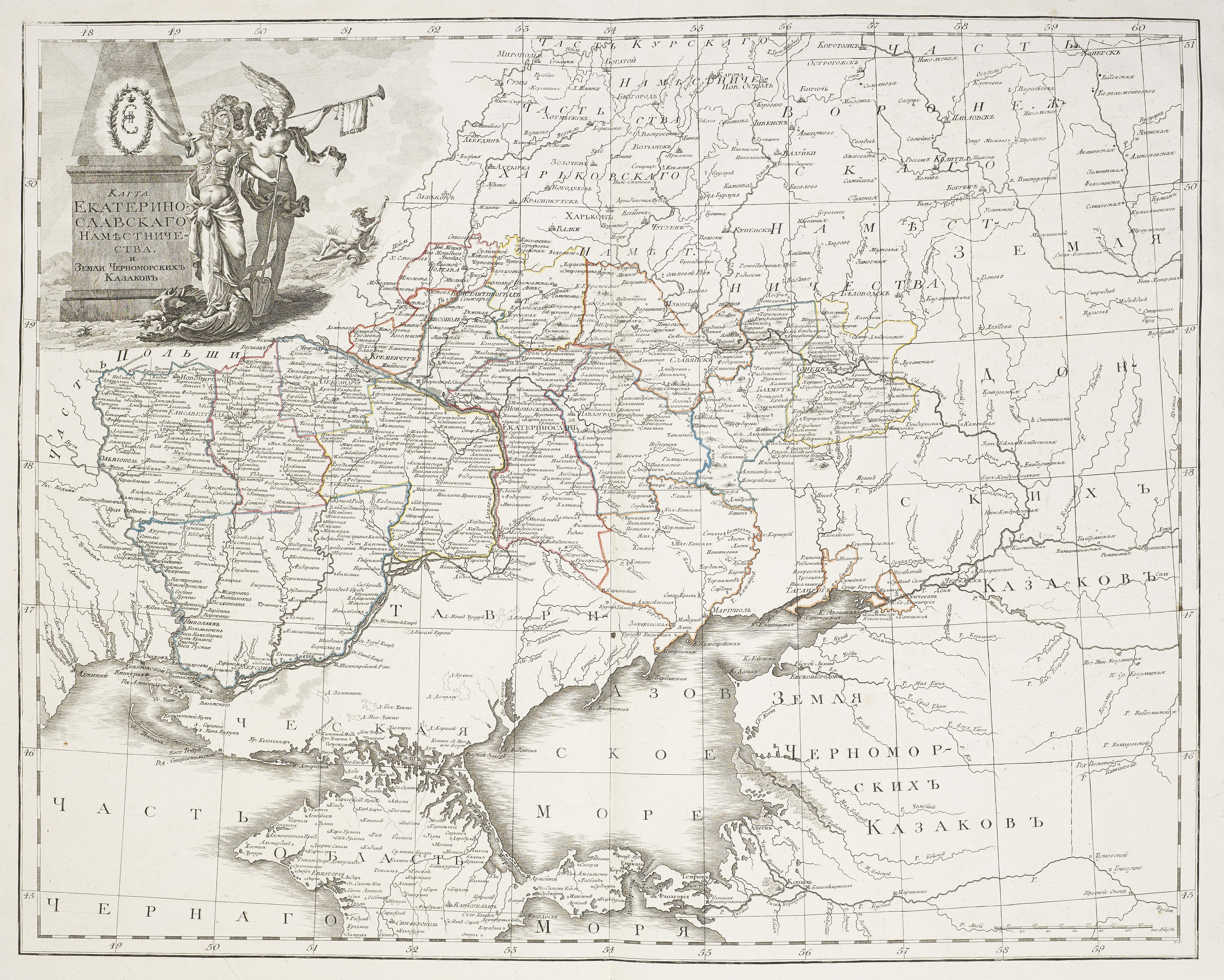
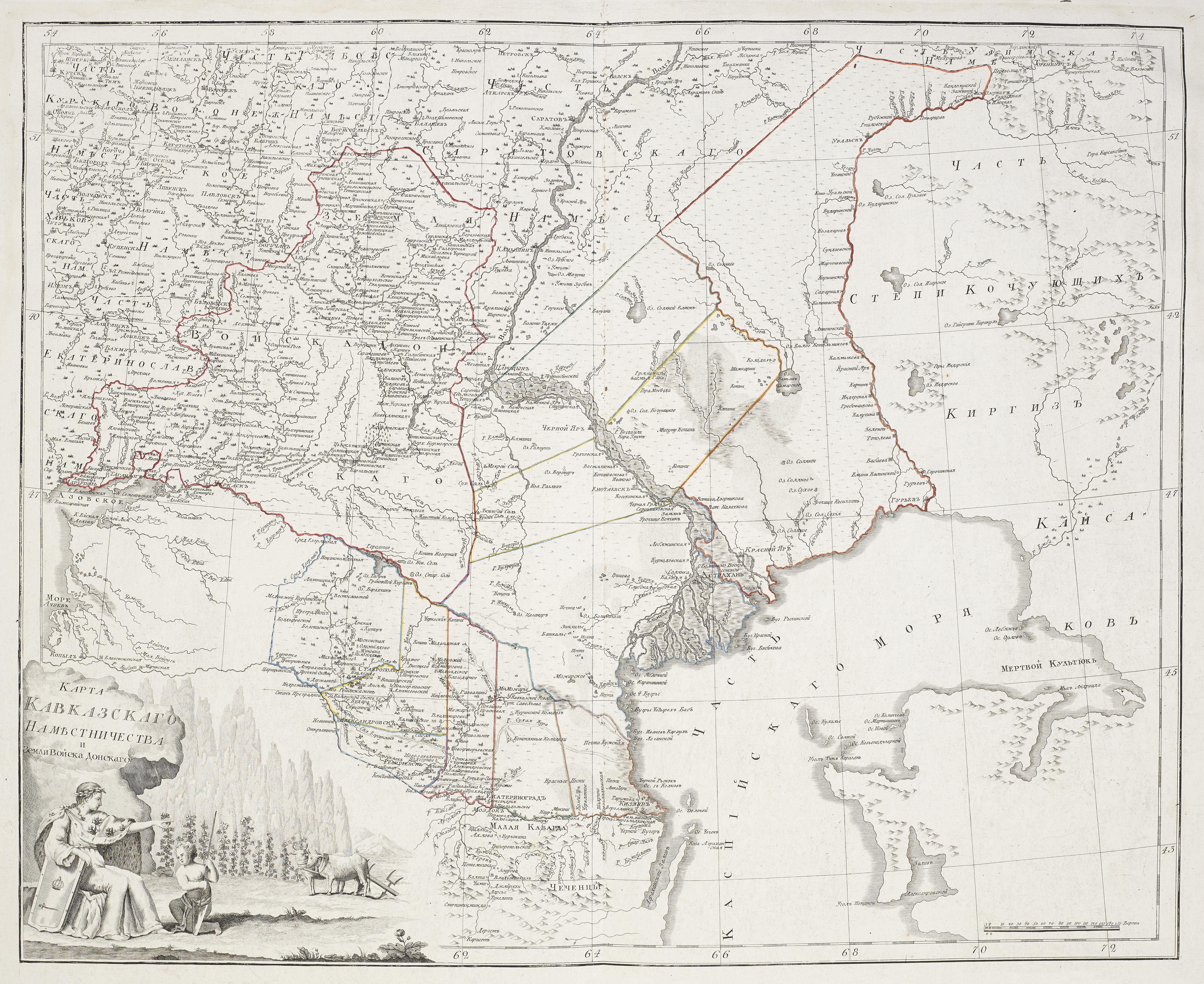
Atlas of Russia consisting of forty-four maps and dividing the Empire into forty-two

   Viceregencies,  yr. 1792. By Alexander Wilbrecht


Российской Атласъ изъ Сорока Четырехъ Картъ состоящй и На Сорокъ на Дв


Намьстничества Империю, 1792 год.


Rossīĭskoĭ atlas iz soroka chetyrekh kart sostai︠a︡shchīĭ i na sorok na dva nami︠e︡stnichestva Imperīi︠u︡, 1792 god.


   The Viceregencies and their uyzeds or counties are well delineated. Some have boundaries that will change after the final

   Partition of Poland in 1795. From the University of Kansas Library Catalog


Karta Rizhskago Namestnichestva   


Full file view (download)


Source: Wikipedia

Karta Polotskago Namestnichestva


Full file view (download)


Courtesy of the University of Kansas

Karta Smolenskago Namestnichestva


Full file view (download)


Courtesy of the University of Kansas

Karta Mogilevskago Namestnichestva


Full file view (download)


Courtesy of the University of Kansas

Karta Novgorod-Severskago Namestnichestva


Full file view (download)


Courtesy of the University of Kansas

Karta Chernigovskago Namestnichestva


Full file view (download)


Courtesy of the University of Kansas

Karta Kievskago Namestnichestva


Full file view (download)


Courtesy of the University of Kansas

Karta Novopriobretennoj Oblasti ot Porty Otomanskoj i prisoedinennoj

Ekaterinoslavskomu Namestnichestva


Full file view (download)


Courtesy of the University of Kansas

Karta Ekaterinoslavskago Namestnichestva


Full file view (download)


Courtesy of the University of Kansas

Karta Tavricheskoj Oblasti


Full file view (download)


Courtesy of the University of Kansas

Karta Kavkazskago Namestnichestva


Full file view (download)


Courtesy of the University of Kansas